


$8,000
$12,900
38.0%For more information regarding the value of a property, please contact us for a free consultation.
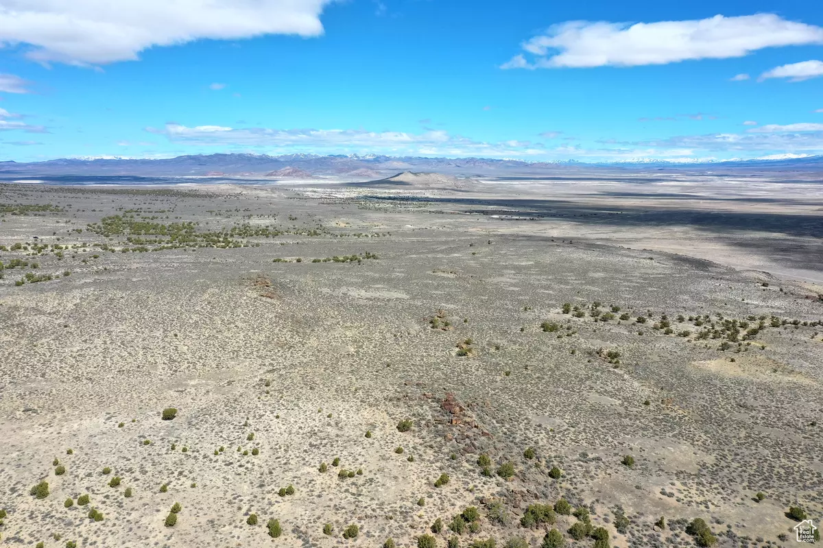
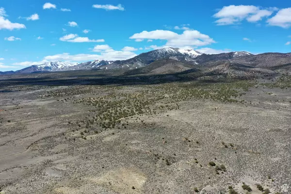
40.33 Acres Lot
SOLD DATE : 01/30/2026
Key Details
Sold Price $8,000
Property Type Vacant Land
Sub Type Recreational
Listing Status Sold
Purchase Type For Sale
MLS Listing ID 2061547
Sold Date 01/30/26
HOA Y/N No
Annual Tax Amount $8
Lot Size 40.330 Acres
Acres 40.33
Lot Dimensions 0.0x0.0x0.0
Property Sub-Type Recreational
Property Description
This property is not far from the Utah/Nevada border South of Lucin and about 5 miles West of the Sun Tunnels. To arrive at the property you take Hwy 30 and turn South onto Pilot Mountain Road. About 7 miles you come on Coal Bank Springs Road and follow that for about 2.5 miles. The property is about .25 miles south of Coal Bank Springs Road. There is no road directly to the property but the topography of the area is gentle rolling hills so a 4wd vehicle should be able to drive right up to the property. Along Pilot Mountain Road you see several landmarks, including the Transcontinental Railroad Line, Lucin Pond, and the Sun Tunnels are about 5 miles East of the property. Vegetation on the property includes Sagebrush, Prairie Grass, Wildflowers and Cactus. In the area I have seen rabbits, squirrel, lizards, Elk, Antelope and Deer. The property has great views of the Mountains to the East and the Salt Flats to the south. There are some rock outcroppings on the property. Soil is mostly sandy. There are no visible structures close to the property. There was a farm just north of the Sun Tunnels. The Sun Tunnels is a large - scale art installation. It consists of 4 large concrete cylinders, arranged on the desert floor in a cross pattern, that align with the sunrise and sunset on the summer and winter solstices. In addition to the solar framing, each of the cylinders has smaller holes representing the Draco, Perseus, Columba, and Capricorn constellations. The four concrete tubes act as viewfinders framing precise images which bring the vast space of the desert back to human scale. This would be a great property for someone who wants to be close to the mountains for recreation or wants to live off grid. The nearest towns with partial services are Grouse Creek to the North, and Montello, Nevada to the West. Wendover, Nevada to the south is the nearest town with full services. The property is Zoned Multi-Use 160. Seller has no water rights. No Utilities are in the vicinity. GPS Coordinates: 41.30625 - 113.96056
Location
State UT
County Box Elder
Area Grouse Crk; Etna; Park Vly; Rst
Zoning Agricultural
Direction SEC/TWN/RNG/MER:SEC 19 TWN 07N RNG 18W ALL THE SW/4 OF SW/4 OF SEC 19, TWP 7N, R 18W, SLM. SUBJECT TO A 25 FT R/W EASEMENT ON ALL BDRY LINES. CONTG 40.326 ACRES. GPS Coordinates: 41.30625° - 113.96056
Interior
Fireplace false
Exterior
View Y/N No
Present Use Recreational,Agricultural
Private Pool false
Building
New Construction No
Schools
Elementary Schools Grouse Creek
Middle Schools Bear River
High Schools Bear River
School District Box Elder
Others
Senior Community No
Tax ID 01-066-0008
Acceptable Financing Cash, Seller Finance
Horse Property No
Listing Terms Cash, Seller Finance
Financing Cash
Read Less Info
Want to know what your home might be worth? Contact us for a FREE valuation!

Our team is ready to help you sell your home for the highest possible price ASAP
Bought with NON-MLS